
Let’s ALL Celebrate the wonders of space together!
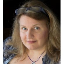
StickTogether recently spoke with Ginger Butcher, NASA Landsat Communications and Public Engagement Lead at NASA’s Goddard Space Flight Center. Ginger has been working at NASA for over 25 years as an award-winning Science Writer and Communications and Outreach Specialist educating the public about Earth science. We discussed many topics. Ginger also shared some great information and resources for all ages.
NASA has been having a moment lately with the first stunning images making the news from the James Webb telescope, revealing first photos of unseen aspects of the universe.
Closer to home on July 23, 2022 the 50th Anniversary of the Landsat program will be celebrated. Ginger shared some exciting news about a FREE 5-Week virtual summer camp called Camp Landsat 2022 starting July 22nd. Each week focuses on a new theme about how Landsat helps us better understand our planet and the activities will remain on their website throughout the year.

In an effort to conduct outreach and inform the public as to some of their missions, NASA Goddard Space Flight Center has many ways to engage with visitors. Over the years they have requested numerous Custom StickTogether images. These have proven to be a fun, rewarding and inclusive way to involve all ages, abilities and personalities with NASA and its missions of discovery.
StickTogether has been thrilled to produce these custom StickTogether images for NASA and the Landsat mission — a partnership between NASA and the U.S. Geological Survey. The Landsat StickTogether images were used for a celebration of Earth Day this year in Washington DC and at the launch of Landsat 9 in Fall 2021 from Vandenberg Space Force Base near Lompoc, California. Look for more StickTogethers to come.

Ginger Butcher – NASA Landsat Communications and Public Engagement Lead, Space Science and Applications, Inc. at NASA Goddard Space Flight Center

Resources for K-12 teachers
You can find Landsat images and resources to help teach about our changing Earth, the electromagnetic spectrum, the science and technology behind satellite data, and much more.
Landsat supports a fundamentally spatial approach to learning and thinking about the world. Spatial thinking is embedded in a multitude of disciplines, from natural resources management to disaster preparedness, disease epidemic prevention, and urban planning.
Using Landsat data and imagery as a basis, students can explore the water cycle, the carbon cycle, urbanization, deforestation, biological diversity, invasive species, fire, and more. National science, mathematics, and geography standards are explicitly addressed in the educational activities available here.

CAMP LANDSAT 2022
Ginger shared some exciting news about a FREE 5 Week activity called Camp Landsat 2022.
This camp will commence 7/22 and the weekly themes will be:
People & Places, Plants & Habitats, Food & Farms, Water & Wellness, Ice & Climate
Ginger Butcher – NASA Landsat Communications and Public Engagement Lead, Space Science and Applications, Inc. at NASA Goddard Space Flight Center